Below is an updated list of tree-related ordinances passed by the city of Asheville.
Sec. 7-19-3. Calculation of tree canopy area.
(a) Any development site greater than two acres in size shall be permitted to determine the area of existing tree canopy coverage to be preserved by ground checking or aerial analysis according to the most recent data provided by the city. Tree canopy calculated by aerial analysis shall be limited to that within the boundary of the subject property. If ground checking is utilized, credit for existing trees intended to be retained may be calculated by the following methods:
(1) Measurement of the trunk of each individual tree (i.e. a tree not grouped with other trees or a part of a forested condition) to determine its diameter at breast height (herein “DBH”) and the credit given for that tree shall be in accordance with Table 7-19.4, below. Heritage trees utilized for credit shall be allowed to count for 200% of the listed canopy value in Table 7-19.4 or measured canopy value; or
(2) The dripline may be plotted on the site plan and tree canopy credit given for the square footage of the area within the dripline as measured using geographic information systems software; or
(3) Measurement of the canopy of each individual tree (i.e. a tree not grouped with other trees or part of forested condition) as illustrated in Figure 7-19.1, “Calculating Tree Canopy Cover.”
(b) For any development site two acres or less in size the area of tree canopy coverage for any group of trees to be retained in order to meet the tree canopy requirements of this Part shall be determined by ground checking. Credit for existing trees intended to be retained may be calculated in either of two ways:
(1) Measurement of the trunk to determine its DBH and the credit given for that tree shall be in accordance with Table 7-19.4, below; or
(2) Measurement of the canopy of each individual tree (i.e. a tree not grouped with other trees or part of forested condition) as illustrated in Figure 7-19.1, “Calculating Tree Canopy Cover.”
(c) Trees planted within one calendar year of the date of development application shall not be included in the calculation of existing tree canopy.
(d) The calculation must be conducted and certified by a forester, land surveyor, civil engineer, landscape architect licensed by the State of North Carolina or Arborist certified by the International Society of Arboriculture.
Table 7-19.4 – Tree Canopy Credit for Preserved Trees
*As found in recommended species list.
**Heritage trees utilized for credit shall be allowed to count for 200% of the listed canopy value in this section.

Table 7-19.5 – Tree Canopy Credit for Newly Installed Trees
| Table 7-19.5 – Tree Canopy Credit for Newly Installed Trees | |
| Size Classification* | Canopy Credit |
| Large | 560 sq ft |
| Medium | 315 sq ft |
| Small | 140 sq ft |
As found in recommended species list
(Ord. No. 4824, § 1h, 9-8-20; Ord. No. 5103, § 1b, 9-24-24)
Chapter 7.2-5 Definitions
Heritage tree means any large maturing tree 30-inches in diameter, medium maturing tree 24- inches in diameter, or small maturing tree 15-inches in diameter in fair or better condition, located on private property within the city limits of Asheville. Trees presenting medium to high risk which cannot be mitigated shall not be considered heritage trees.
Chapter 7-19
Sec. 7-19-3. Calculation of tree canopy area.
(a) Any development site greater than two acres in size shall be permitted to determine the area of existing tree canopy coverage to be preserved by ground checking or aerial analysis according to the most recent data provided by the city. Tree canopy calculated by aerial analysis shall be limited to that within the boundary of the subject property. If ground checking is utilized, credit for existing trees intended to be retained may be calculated by the following methods:
(1) Measurement of the trunk of each individual tree (i.e. a tree not grouped with other trees or a part of a forested condition) to determine its diameter at breast height (herein “DBH”) and the credit given for that tree shall be in accordance with Table 7-19.4, below. Heritage trees utilized for credit shall be allowed to count for 200% of the listed canopy value in Table 7-19.4 or measured canopy value.
Sec. 7-19-5. Payment in lieu of compliance.
“ Payments in lieu of compliance received in relation to properties within a given Resource Management Overlay District shall be used to acquire land and plant or preserve trees within that same Resource Management Overlay District.”
https://codelibrary.amlegal.com/codes/ashevillenc/latest/asheville_nc/0-0-0-9933
What is happening to payment-in-lieu money? (add this)
o Can fee in lieu fund incentives to homeowners? (no).
Only for tree planting or property purchase. Currently stalemated and in limbo since there is not an approved policy to use the funds.
Sec. 7-19-6. Permitting.
https://codelibrary.amlegal.com/codes/ashevillenc/latest/asheville_nc/0-0-0-9933
Tree removal permits.
(1) A permit shall be required for the following activities:
a. The removal of any trees on properties within any steep slope zone or an aquatic buffer.
b. The removal of any tree within an established tree canopy protection area.
Sec. 7-11-3. Landscape and buffering standards.
https://codelibrary.amlegal.com/codes/ashevillenc/latest/asheville_nc/0-0-0-6815
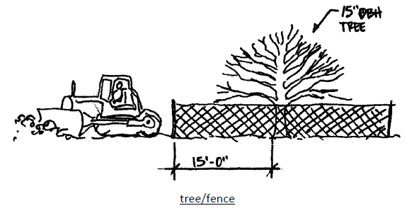
Note fence for critical root zone! (in the policy!)
TPTF is requesting:
- Re-instate the Urban Forestry Commission.
- Develop a tree ordinance for residential areas. The current tree protection ordinance is only for commercial development (and housing development), not for individual residential homes.
- Incentives for private homeowners to preserve both on their property and in the public right of ways.
